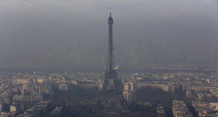
The smoke from wildfires that have ravaged Canadian forests have reached France, creating what the weather channel described as a “milky hue” that was milder than the darkened skies that temporarily clouded the British Isles.
Three-quarters of the country is affected, Météo France forecaster Joris Vallon told FranceInfo radio.
The particles are expected to continue their shift east on Thursday before being swept beyond French borders on Friday.
Satellite images showed that smoke from Canada’s wildfires, which have been burning since the start of the year and are the country’s worst on record, reached the UK on Monday after first arriving in Norway.
Fast-moving
The smog had traveled across the Atlantic Ocean via the fast-flowing jet stream air current.
Mark Parrington, scientific director of the Copernicus Atmosphere Monitoring Service (CAMS) which has been following the plume, said carbon monoxide had an atmospheric lifespan of about a month, making it a “very good smoke transport tracer”.
However while concentrations of ash particles and carbon monoxide – an invisible, odorless, toxic gas – will be at their highest on Wednesday, they are not expected to cause a significant drop in air quality.
UN warns of new heat records as El Nino expected to return
Global warming is likely to breach 1.5C for the first time within the next five years.
This is because ash particles are circulating at high altitudes of between 4,000 and 8,000 meters – at cloud level – and are expected to remain there throughout the week.
“Whilst the smoke is high up in the atmosphere, it may make for some vivid sunrises and sunsets in the next few days,” the UK’s Met Office wrote on Twitter.
CAMS said the fires burning through 7.4 million hectares of forest in eastern and western Canada had released a record 160 million tonnes of carbon.
As of June 26, the annual emissions from the fires are now the largest for Canada since satellite monitoring began in 2003.


